HuntPack
Appen for jaktlaget
The app for your hunting team
Se hvor alle på laget er, sett ut poster og merker, følg vinden og hold styr på jaktdagen – på et felles kart som fungerer også der det ikke er dekning.
See where everyone on the team is, place stands and marks, follow the wind and keep track of the hunt day – on a shared map that works even without coverage.
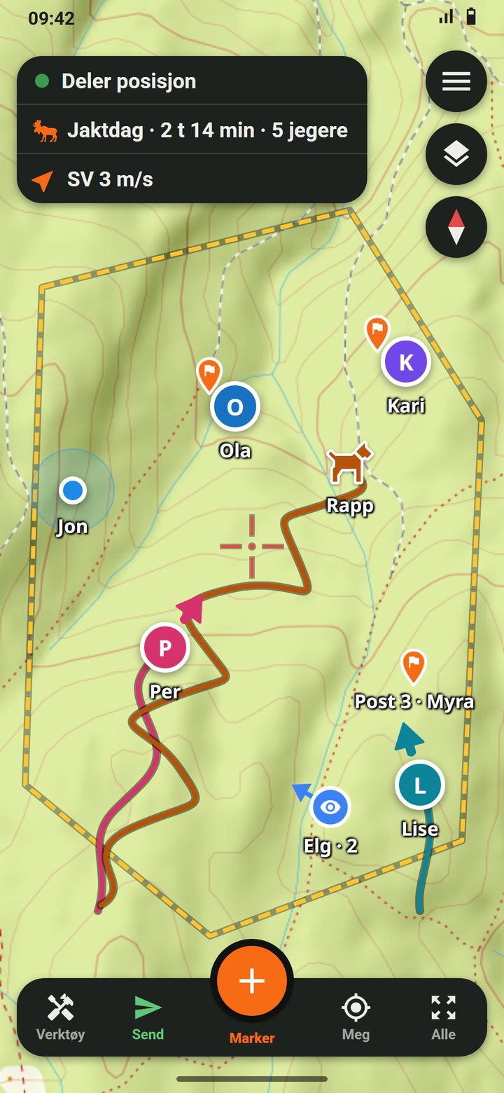
- Hvor er alle?Where is everyone? Posisjon og spor for jegerne og hundene på laget, med batterinivå. Positions and tracks for the hunters and dogs on the team, with battery level.
- Poster og merkerStands and marks Poster, observasjoner, skudd og ettersøk – synlig for hele laget. Stands, sightings, shots and tracking – visible to the whole team.
- VindWind Vindretning og -styrke på kartet, så du ser hvor vitringen går. Wind direction and strength on the map, so you see where your scent goes.
- JaktdagerHunt days Hvem som jakter i dag, jaktform, og rapport om sett og skutt. Who is hunting today, the type of hunt, and a report of animals seen and shot.
- Grenser og kartBoundaries and maps Jaktfeltets grenser, topografiske kart og flyfoto. Hunting ground boundaries, topographic maps and aerial photos.
- Uten dekningNo coverage Last ned kartet på forhånd. Det du legger inn, sendes når du får nett igjen. Download the map in advance. What you add is sent when you are back online.
HuntPack testes nå av jaktlag og kommer snart for både Android og iPhone – på Google Play og App Store.
HuntPack is being tested by hunting teams and is coming soon for both Android and iPhone – on Google Play and the App Store.
Ta kontakt
Get in touch
Har du spørsmål, ønsker eller lyst til å prøve HuntPack med jaktlaget ditt? Send oss en e-post, så svarer vi så fort vi kan.
Questions, ideas, or want to try HuntPack with your hunting team? Send us an email and we will get back to you as soon as we can.
✉ [email protected]